

Discover Sonoma Coast State Park
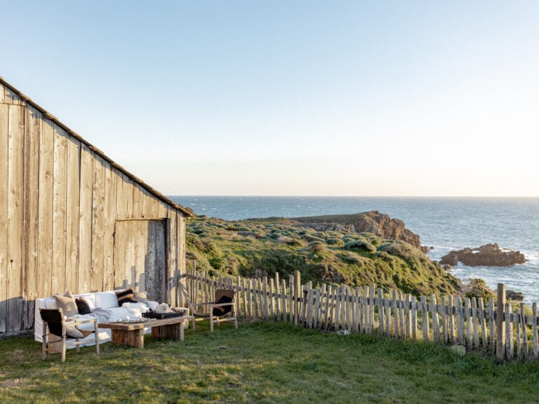
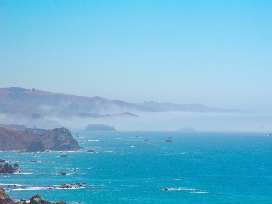
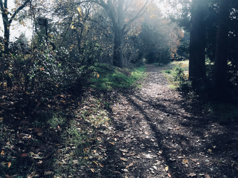
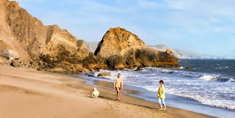
There’s a definite tendency to linger in Sonoma Coast State Park, which offers rocky bluffs, sandy beaches, hidden coves, and absolutely stunning views along 17 miles of Pacific Ocean coastline in Northern California’s Sonoma County.
It’s worth taking your time to explore the nooks and crannies and absorb the beauty of this amazing park, which stretches along Highway 1 from Bodega Bay in the south to about four miles north of the town of Jenner. Between those two points, the park offers a rugged, natural splendor that can take your breath away.
Together, we can protect and preserve the beauty and natural resources of Sonoma County for generations to come. Check out our page on Sustainable Travel, and look over the Leave No Trace Seven Principles.
Planning Ahead
Coastal weather often varies: it can be foggy in the morning, particularly in the summer, and then burn off by midday to let the sun shine through. Of course, the cool ocean breezes make the coast a summer haven for those seeking relief from the inland heat. All of which means that you need to bring layers of clothing you can take off as it warms up or put on when it cools down.
Beachcombing, sunbathing, picnicking, fishing, camping, boating, kayaking, hiking, horseback riding, and bird watching are all popular activities in Sonoma Coast State Park. However, because of the cold water, strong rip currents, heavy surf, and sudden swells, it’s not safe to swim here. Keep children back from the highest water-line mark and never turn your back on the ocean. (If you do want to dip your toes in the water and wade a bit, visit nearby Doran Regional Park, where the two-mile-long sandy beach is within the protective Bodega Bay.)
If you want to bring man’s best friend with you, dogs on leashes no more than six feet long are allowed on some but not all of the state park’s beaches.
Volunteers from the nonprofit Stewards of the Coast & Redwoods often offer docent-led tours, adventures, and special events in Sonoma Coast State Park; check their list of Upcoming Events & Programs.
Getting There
It’s a little more than an hour’s drive from San Francisco’s Golden Gate Bridge to the southernmost point of this park, but even this first part of the trip is a beautiful route. Take Highway 101 north, and in the Sonoma County town of Petaluma take the Highway 116/Lakeville Street exit. Head west on Lakeville, and then left on East Washington Street, which first turns into Bodega Avenue and then becomes Valley Ford Road as it winds its way through charming farmlands and rolling hillsides. When it reaches Highway 1 and the Pacific Coast, head north to Bodega Bay and the start of your Sonoma Coast State Park adventure. You can pretty much explore the park simply by following Highway 1 north, although there will be a few side roads to reach some of the attractions.
In The Park
Here’s a roundup of places to stop and explore, from the southern end of Sonoma Coast State Park to its northern border.
Bodega Head

A rocky peninsula that forms the entrance into Bodega Harbor, Bodega Head is a popular whale watching spot because of its stunning bluff top views. From Highway 1, go west on Eastshore Road, right onto Bay Flat Road, and then continue straight on Westshore Road, which eventually leads to the bluff top parking lot for Bodgea Head. Trails circle the bluffs, but also lead down to beaches in hidden coves. For details about all this area has to offer, read Explore Bodega Head on the Sonoma Coast.
Bodega Dunes Campground

It’s easy to spend the day exploring the vast and remote beach here. There are also many trails through the sand dunes, all open to hikers and some to horseback riders. The day-use parking lot is at the end of a windy paved road just inside the park entrance gate. An accessible path and boardwalk leads to a viewing platform and an elevated ramp to the beach. Bodega Dunes offers 99 campsites (mostly tucked back under the trees, where it’s a little less windy), token-operated hot showers, flush toilets, a potable water fill station, and a trailer sanitation dump station.
South Salmon Creek Beach
and North Salmon Creek Beach

These two beaches are side-by-side, where a lagoon forms as sand closes the mouth of Salmon Creek. The south beach runs south of the creek and the north beach stretches to the north, with separate parking areas for each. Here you can wander along nearly two miles of unbroken, scenic, sandy beach. This is a great place for surf fishing, beachcombing, and picnicking – and if the waves are good, it’s also popular with the local surfing community. Birds and seals sometimes gather at the Salmon Creek sand spit.
Note: Because of federal protection of the snowy plover birds, no dogs, horses, or fires are allowed on either beach.
Miwok Beach

There’s a small pullout parking area signed for Miwok Beach on the west side of Highway 1. A short trail with a small wooden bridge over a creek takes you down to the beach, which is named after the Coast Miwok Native Americans who lived in southern Sonoma County long ago. It’s best to visit at low tide; the narrow shoreline will be mostly wet at high tides. Just to the south is Coleman Beach, which can only be reached by walking from Miwok Beach at lower tides.
Arched Rock Beach
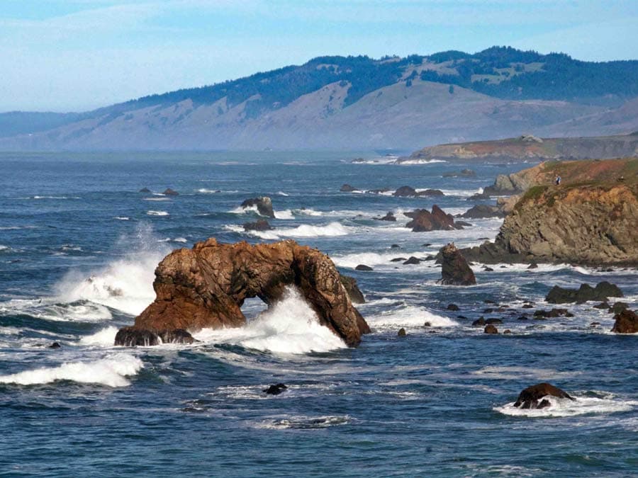
There’s a signed parking lot for this beach on Highway 1. That path to the beach requires a bit of a scramble, and is best attempted when it’s dry. Look to the north from this beach and find the big rock with a hole in it that gives this place its name. The arched rock is actually right next to Marshall Gulch Beach, but it isn’t possible to see the arch from that beach.
Marshall Gulch

A short hike down the embankment from the parking lot on Highway 1 takes you to this small, popular, fishing beach, located where Marshall Gulch Creek reaches the Pacific Ocean. At low tide you can walk between the rocks to the north and south to other small coves.
Carmet Beach

Steep trails take you from the parking lot along Highway 1 down to this narrow, rocky, fishing beach. The southern cove is the widest and sandiest, and connects to Marshall Gulch Beach. The northern cove extends north along a narrow boulder-filled shoreline that continues up to Schoolhouse Beach. It’s best to visit at low tide: at high tide these beaches can be unsafe because of the rough surf and narrow shoreline, and random large ‘sneaker waves’ that crash onshore unpredictably.
Schoolhouse Beach

Rock fishing and surf fishing are popular activities on this stretch of sandy beach, with a large parking lot just off Highway 1. It’s best to visit at low tide.
Portuguese Beach

Popular for rock and surf fishing, this sandy beach is best visited at low tide. The main parking lot is at the south end of the beach, where you can walk out onto a grassy point and watch waves crash on the rocks. There is another pullout parking area just north along Highway 1 that has a steep path to the center of Portuguese Beach. At low tide you can walk north along the shoreline to pebbly Scotty Creek Beach, which is one of the few in the area that is not part of the state park.
Duncan’s Landing

Duncan’s Landing is famous for two things: as an early-day landing for loading small coastal ships with lumber and food products and for being the most dangerous point along the Sonoma Coast due to large and unpredictable surf. Heed the signs and stay off the rocks (waves can come up as far as the parking lot).
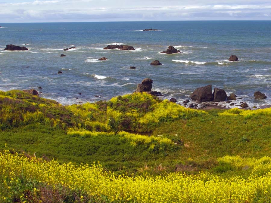
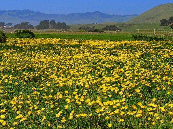
In the spring, the wildflower displays are spectacular here. Duncan’s Beach is below the landing; there are steep trails down to it from the Landing parking lot on Highway 1, and from another parking area a bit to the south.
Gleason Beach

From the south part of the Duncan’s Landing parking lot on Highway 1 there’s a steep trail down to this narrow, rocky beach. It’s best to visit at low tide, when you can walk in and out of huge sea stacks (massive vertical columns of rock) that dot the shoreline. At the north end of Gleason Beach is Rock Point, a pullout picnic area just off Highway 1 that is not meant to provide beach access, but there is a scramble route down the bluff, next to a huge rock.
Wright’s Beach
Located at the edge of a pleasant sandy beach, this campground offers 27 developed campsites for tents or RVs. Several of the sites offer ocean views, which are perfect for campers who want to be right on or near the beach. Maximum trailer length is 27 feet; no hookups are available. Each site has picnic tables, fire rings, and paved parking spurs. Running water and flush toilets are nearby. There are no showers, but campers may use the hot showers at nearby Bodega Dunes Campground. When the campground is filled, the overflow area in the Wright’s Beach Picnic Area may be used for self-contained vehicles. Reservations are recommended, especially on weekends and during the peak summer season.
Kortum Trail
This well-maintained and relatively easy bluff-top trail winds through coastal prairie from Wright’s Beach to Blind Beach (about 4.5 miles one way), offering sweeping views of the ocean and offshore sea stacks (massive columns of rock). Much of this trail is along a double plank wood walkway that goes over wetlands. For the more adventurous, there are optional side trips down to the beach or up the trailside rock outcroppings. You can pick up the Kortum Trail at Wright’s Beach, Shell Beach, or Blind Beach.
Shell Beach

This narrow, rocky beach is great for beachcombing and exploring tide pools. Getting to the beach requires a short hike down a path that drops steeply. The trail can be slippery when wet, so take good shoes just in case. Fishermen enjoy this area for its variety of fish, and the Kortum Trail runs through here along the bluff, offering incredible views. The Shell Beach parking lot is off Highway 1 just south of Pacific View Drive, and a few overflow spots can be found at the end of Pacific View Drive.
Pomo Canyon Trail

Covering 6.2 miles round trip (out and back) and with an elevation change of 650 feet, this dramatic trail takes you from pounding surf to towering redwoods, and from ridge-top vistas to ferny dells. Following an ancient trading route of the Pomo and Miwok people, the trail begins at Shell Beach and heads east, crossing Highway 1 and traveling upward into a redwood forest with a waterfall. Rated moderate, this gorgeous hike starts with long steady uphill segments, levels off along the ridge, and then takes a steep drop down into Willow Creek. The gorgeous scenery is worth the climb.
Blind Beach
This long, narrow beach is great for beachcombing and fishing, and offers a good view of the arched rock. To reach Blind Beach, turn onto Goat Rock Road, which is about one mile south of the Russian River Bridge. There’s an upper parking lot with a steep narrow trail that descends to Blind Beach, but sometimes the lot is closed; there are shoulder spots outside the parking lot for a few cars. Blind Beach is also the northern end of the Kortum Trail.
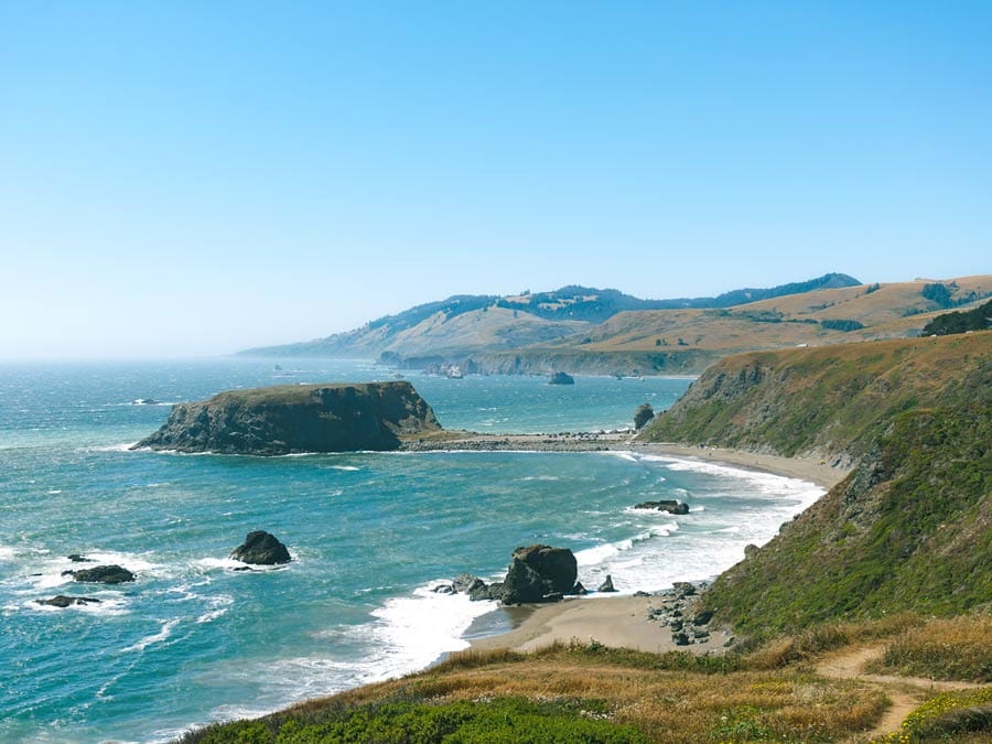
Goat Rock Beach

Located near the mouth of the Russian River at the end of Goat Rock Road, Goat Rock Beach is known for its scenic shoreline and easily accessible sandy beach. It offers picnic tables and restroom facilities, and is home to a colony of harbor seals. For more details, read Discover Sonoma County Marine Wildlife at Goat Rock Beach.
Jenner Beach

A few steep paths lead down to this driftwood-covered beach on the north side of the mouth of the Russian River. If the river mouth is closed (when the river is not flowing through the beach), you can reach Jenner Beach by walking north from Goat Rock Beach (but stay back 50 yards from the harbor seal colony). There’s a boat launch at the Jenner Visitor Center in town, making Jenner Beach a good pull out spot when exploring the river by small watercraft.
Jenner Visitors Center
Run by the volunteers of the nonprofit Stewards of the Coast and Redwoods, this cute little visitors center is typically open weekends in the winter and daily in the summer season. The center is not actually in the Sonoma Coast State Park, but it’s right nearby and worth a side trip. It includes interpretive displays of local history, flora, and fauna, a wonderful nature store, and information about local lodging, restaurants, and things to do. There’s a deck with great views of the water, and a small boat launch, for those who want to explore the area in small watercraft.
Next door you can get a casual, organic meal and a hot cup of coffee at Café Aquatica, browse at Jenner Sea Gifts & Wine, and sip and relax at Tasting by the Sea wine bar, with great views from the outdoor deck in the back of the building.
Willow Creek Campground
When open, this seasonal campground along the Russian River offers 11 first-come first-served primitive campsites (no reservations), with fire rings, picnic tables, and pit toilets. The walk-in campsites are within a quarter mile of the parking lot. They are mostly shaded by willows and relatively close to a large beach for swimming and fishing. Blue heron, egrets, osprey, and occasionally river otters can be seen by the river. To protect the wildlife, no dogs are allowed. There is no water available, all trash must be carried out, and camping is only allowed in the designated number campsites.
Russian Gulch

Located north of Jenner where Russian Gulch Creek flows into the Pacific Ocean, this pebbly beach is in a deep cove with high rocky headlands towering overhead. The parking lot is just north of the Highway 1 bridge over Russian Gulch. From the lot, one hiking trail goes down to the creek bed and one goes straight out to the beach. Note: There’s a strong rip current here, so remember, no swimming.
Vista Point Overlook

The northernmost end of Sonoma Coast State Park, this high ocean overlook doesn’t offer beach access, but it does have a gorgeous view, a picnic area, and a one-mile scenic trail, called the Vista Trail Loop. This is a popular spot for whale watching during the migration season. The trail and the overlook are handicapped accessible.
Other possibilities
Located next to the Sonoma Coast State Park about 1-1/2 miles north of the town of Jenner, the Jenner Headlands Preserve includes 5,630 acres of redwood and Douglas fir forests, oak woodlands, chaparral, and coastal prairie overlooking the Pacific Ocean. The property includes incredible views and about 14 miles of hiking trails, which are mostly old ranch and fire roads. The parking lot includes restrooms, and access to a 400-foot accessible vista trail. There’s also a trail to the adjacent Pole Mountain, which offers unobstructed views from the 2,204-foot summit; it’s 15 miles round trip, with a total elevation gain of about 3,500 feet).
For more ideas about what to see and do, read 5 Fun Things to Do in Bodega Bay and 48 Hours in Jenner on the California Coast.
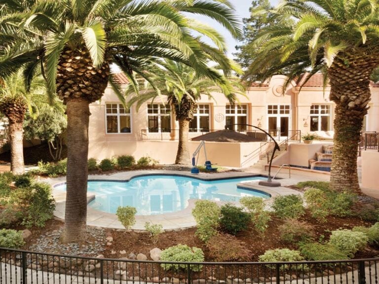
For places to spend the night, read 10 Unique Hotels and Inns on the Sonoma Coast or check our listings of Hotels, Motels & Lodges.
And when you’re ready to eat, read Top Seafood Restaurants in Bodega Bay or check our listings of restaurants.
Lush greenery, foggy coastlines, seasonal harvests and unique wildlife sightings – Sonoma County in winter is a place where visitors…
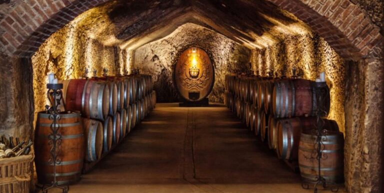
Without a doubt, Wine Country is one of the world’s most breathtaking regions to travel through whether you are looking…

Winter might be considered the off-season for many of the world’s hottest travel destinations, but a Wine Country visit between…

Need a pick-me-up? These nonprofits offer ways to spend time with cute animals — you could even try some goat…
Springtime in Sonoma County is hard to beat! Plan ahead with our weekend-by-weekend, month-by-month collection of popular experiences — from…
Traveling mindfully to Sonoma County allows us to have experiences that can be savored in a place focused on and…
From lodging properties to transportation services, here are a few traveling tips and recommendations of places to visit in Sonoma…
More than (just) a premier Wine Country destination, Sonoma County’s myriad of options allow travelers to connect with the destination…
Find hidden gems, outdoor adventures and more with tips from those who know the coast better than anyone: The locals….
The term “ghost wineries” may conjure images of restless spirits wandering winery corridors, but it doesn’t refer to haunted vineyard…
See What’s Happening
Share your experience using #SonomaCounty or #LifeOpensUp